The ghost town of Tybo is located in Tybo Canyon, on the east side of the Hot Creek Range. It is about 80 road miles or 90 minutes drive from Rachel, and well worth exploring.
After the first discoveries of ore in the Hot Creek Range in 1866 the first major discovery in Tybo was made in 1870. But it was not until 1874 that a small camp was established in Tybo Canyon. Most mines were producing lead, later also silver and zinc.
Tybo Consolidated Mining Company was founded in 1875 by several of the larger mines, and soon controlled the town. By 1876 Tybo was booming, and the population had reached 1,000. Many businesses opened, including several stores, saloons, restaurants, a hotel, a blacksmith, a school, a post office, a bank and a newspaper (the Tybo Sun).
In 1880 the mining company began running into problems, and by the end of 1881 the population had dwindled down to less than 100. In the following decades numerous mining companies tried to reopen and expand the old mines, but all of them failed within a few years. Since the late 1930's there has been no significant mining activity. However, even today a few people live in some of the cabins on-and-off, including a caretaker of the mine.
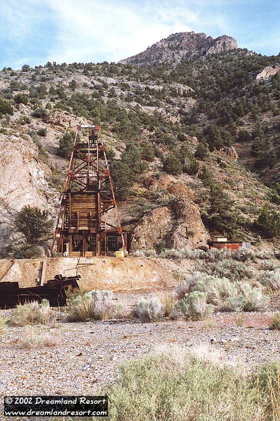
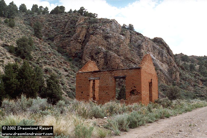
The remains of Tybo, including a couple of more recent mining operations, are easy accessible from the road. Some of the buildings are in fairly good condition. Especially the old general store, a wood building with a brick front, is worth exploring. Most of the mines are scattered all over the surrounding mountains and require a more or less strenuous hike. The headworks shown below are part of a more recent mine in town, and are easy to get to. There are several interesting buildings with old mining machinery in that area.
From Rachel turn left onto Hwy 375 north. Follow it for about 59 miles. At the Warm Springs junction turn right onto US-6 east. After 9.7 miles you see the Tybo historic marker on the right side of the highway. On the left side of the highway is a group of buildings and an airstrip. Follow the well-maintained dirt road past the buildings towards the mountains in the west. After 4.1 miles you come to a fork in the road. Take the left fork. After 8.6 miles you come to Tybo. Suitable for most vehicles.
| Rachel | N 37° 38.801' | W115° 44.760' | ||
| Queen City Summit | N37° 45.129' | W115° 56.733' | ||
| Warm Springs | N38° 11.447' | W116° 22.218' | ||
| Basecamp | N38° 18.705' | W116° 16.807' | ||
| Fork, keep left | N38° 21.084' | W116° 19.777' | ||
| Tybo | N38° 22.176' | W116° 24.019' |
We have received several reports of new "No Trespassing" signs at the entrance to the Tybo Canyon. Apparently some of the roads and historic buildings have been restored, and new buildings and power lines were added. We have no further information about the new owners or whether the signs have any legal ground, but access to Tybo may no longer be possible.
As reported above some of the historic buildings of Tybo have been restored and are inhabited. Access to Tybo Canyon is possible but if you explore the area please do not bother the local residents and respect private properties.
|
 |